
On the morning of the first day I met the staff that we would be working with including Dr Rajiv Sinha, the head of the earth sciences department, who is helping/co leading the project and has kindly let us use the facilities and the equipment
The exciting news it that IIT Kanpur have just purchased a Trimble UX5 which is a very advanced fixed wing UAV (the first one in India!) which we will now be using. This enables us to vastly increase the area we cover and the data that can be collected and will be flown by Depro who is assisting in the research and about to progress to his PhD.
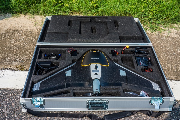
In the afternoon we studied the camera in the UX5 (an adapted Sony Nex 5 with custom lens) using imaging software to see the parameters of the distortions in the lens of the camera. These will need to be corrected when producing the Digital Elevation Models (DEMs) in order to give more accurate models and data to see more accurately whether the small channels we will be mapping cumulatively contain enough volume to transport a significant amount of water into the Ganges (and the pollution with it). The tests came back well and showed that the adapted Trimble lens had lower distortions than stock lenses which created bulges when imaging flat objects.
We also ran some tests beginning to process the images taken of the IIT airfield during its first practice flight before we arrived to see the lens distortions from an aerial perspective. We are going to fly it tomorrow at a lower altitude for its 2nd ever flight to gather images of the campus airfield again at greater resolution and then check those with points generated by the DifferentialGPS (DGPS) to see what distortion the pictures from the UAV generates while flying.